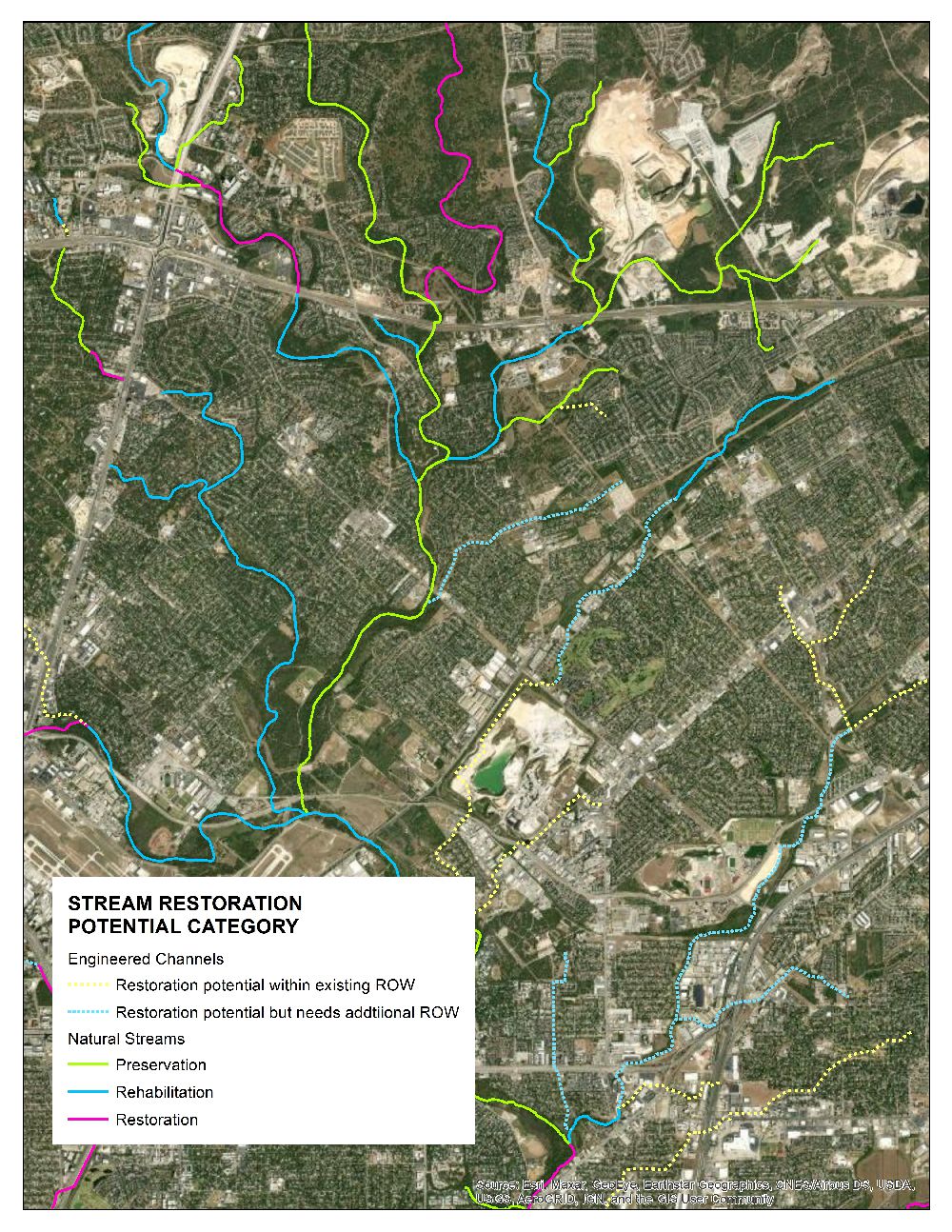
Stream Restoration Potential – a GIS-Based Master Planning Tool
The San Antonio River Authority (SARA) is charged with developing and conserving water resources for over 3,650 square miles of Bexar, Wilson, Karnes, and Goliad Counites. Since 2009, SARA has worked with local partners to develop holistic Watershed Master Plans for the watersheds in their jurisdiction. The Master Plans serve as planning tools to identify needs and opportunities, develop and assess proposed projects, and identify preservation opportunities within a large geographical area.
EPR staff assisted in developing the Stream Restoration Potential (SRP) GIS desktop tool that is used for master planning purposes. The tool classifies stream type and condition by evaluating stream geometry parameters along with a visual assessment of riparian buffer conditions, visible bank erosion, land-use practices, and potential watershed development practices. The SRP tool supports all of SARA’s holistic master plans, and SRP results have been integrated into SARA’s Sustainable Development Review process, added to the scoring criteria for City and County Capital Improvement Projects, and included in SARA’s Watershed Master Plan and SA Tomorrow online map viewers. To date, EPR has used the tool to assess over 1,600 miles of streams.